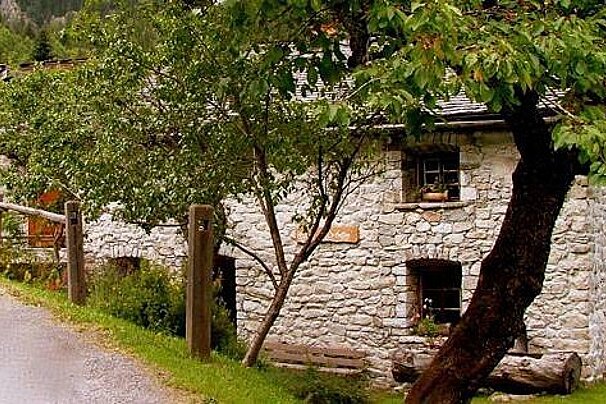
Maison de Barberine museum
Situated in an 18th century house, the Barberine museum is dedicated to showing pastoral life of the Vallorcine people in the valley since the 18th century.
© Alison Shayler

© Alison Shayler

© Alison Shayler

© Alison Shayler
A challenging ascent that is rewarded with great views over the Domaine de Balme
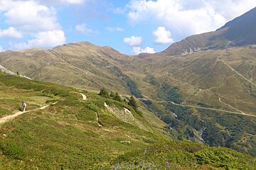
This hike takes in a rolling expanse of alpine meadows interlaced with streams and hiking trails on the Franco-Swiss border.
Starting from the tiny village of Vallorcine, go behind the train station and turn left.
There are two options for the ascent; the wide 4x4 track that is a winter ski run or the narrow footpath up Plan Envers.
The 4x4 track is far less steep but follows a slightly more meandering route that will take longer, the footpath is a bit of a beast to start with but mellows out a bit once you get into the forest - the choice is yours.
Either way, you’ll soon leave the valley behind and start climbing up through a beautiful forest where you can sometimes come across bouquetin and chamois. Little streams trickle down over the rocks and you quickly feel quite far away from civilisation.
If you’ve come up the 4x4 track then once you’ve reached the bottom of the Tête de Balme chairlift (out of action in summer) you need to keep an eye out for a right hand turn up to Col des Posettes. If you’re on the footpath then turn right when you come out of the forest and you’ll be heading in the right direction.
The route continues upwards, winding it’s way up to the top of the Vallorcine gondola. There can be snow up here even in early summer, so make sure that you have decent boots on if you’re up here before mid-June.
The terrain flattens out soon after the lift station and you’ll come to the wide open expanse of the Col des Posettes; a mountain pass where you can see the meadows unfolding beneath you and Chamonix Valley stretching out into the distance. The peak to your right is the Col des Posettes, the highest point of the Marathon du Mont Blanc and worth a scramble up there if you’ve the time and the energy.
From the Col des Posettes you can more or see your route down to the Le Tour lift station, as the paths are all fairly visible. Follow the signposts for Charamillon and you’ll find yourself on a nice wide path that skirts around the mountainside, crossing a small ravine where the Torrent de Balme flows through.
The path brings you to the top of the Charamillon gondola, which you can ride back down to the Le Tour car park. If you want to continue on foot, then the signposted route that sets off just before the lift station is quite short and very beautiful.
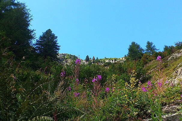
The landscape up here is rugged with lots of heather, bracken and wild berries packed tightly in amongst the rocks. It feels very different to the other Chamonix hiking areas, in that once you’ve made the ascent it feels more like rolling moorland than high mountain terrain.
The views down the valley are quite breathtaking, with the Mont Blanc Massif on your left and the peaks of Le Buet, Flégère and Brévent on your right.
Parts of the path are quite rocky underfoot and the area around the top of the Vallorcine gondola can be snowy even in late spring, so wear decent hiking boots and consider using poles.
This isn't a particularly long or technical hike, so you won't need anything beyond the usual supplies of drinks, snacks, suncream and weather-appropriate clothing.
The map for this area is IGN 3630OT.

Situated in an 18th century house, the Barberine museum is dedicated to showing pastoral life of the Vallorcine people in the valley since the 18th century.
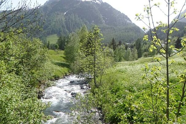
Le Tour is a small, quaint little village at the far end of the Chamonix valley in the 'Domaine de la Balme' area with access to some great hiking and mountain bike trails.
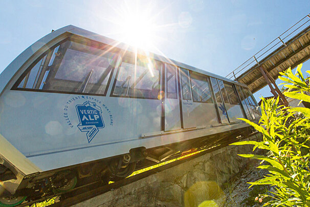
At the edge of the Franco-Swiss border lies the 'VerticAlp' experience, which is made up of a steep funicular, a panoramic train and a smaller funicular taking you up to the Emosson Dam.
The Aiguilles Rouges Nature Reserve was created in 1974 and is a bio-diverse area of around 16,000 hectares with spectacular views of the Col des Montets. There is an information centre where you can find out about the animals and plants of the area and buy a drink or snack.

The Plan Joran télécabine takes you up to Grands Montets at an altitude of 1,972 metres.

In summer the cable car at Flégère and the Index chairlift operate, taking you up to an altitude of 1,894m and then on to 2,396m at the top of the Index.
There is a restaurant at the top of the Charamillon gondola but it is a bit canteen-style and not renowned for great food or service. If you want to make a bit of a detour then the Refuge de Balme is a picturesque spot to enjoy a traditional alpine lunch, or wait until you get down to Le Tour and grab a sandwich on the sunny terrace of the tiny Café Le Passon.

Café Comptoir is open winter and summer, this place serves delicious food in a beautiful mountain-side setting.

Nestled just over the Col des Montets in the beautiful surroundings of Vallorcine, this wonderful restaurant serving traditional dishes from the region.

Explore the fantastic natural scenery around Vallorcine, Le Tour and Montroc by going off the beaten track on snowshoes!
Vallorcine is at the far north end of the Chamonix valley, just before the border with Switzerland. It is easily reached by train and the station is right beside the lift station.
Le Tour is in between Vallorcine and Argentière; there is a bus stop in the Le Tour car park at the bottom of the lift station, or you can walk for about 5 to 10 minutes to reach the train station at Montroc.
Find out all about what is happening in the Chamonix valley and how to make the most of your time here. The latest news, reviews of fun activities, current events and the trendiest restaurants, as well as interviews with leading locals, insider's guides and our top choices for things to do, see and experience in the valley. Plus, during the winter season, our famous snow reports and dump alerts all in the same place.
See allLatest News & ReviewsChamonix hosts a wide range of sporting events throughout the year. The biggest ones include the Mont Blanc Marathon in June and the UTMB trail running race in August. In March, the Unlimited Festival brings ravers to the mountains while Musilac Mont Blanc takes place a month later. At the end of July, the Cosmo Jazz Festival hosts concerts all around the valley.
See allUpcoming Events