Maps of Chamonix
Download the essential Chamonix maps and plans
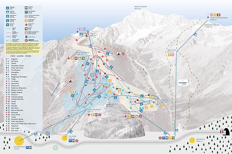
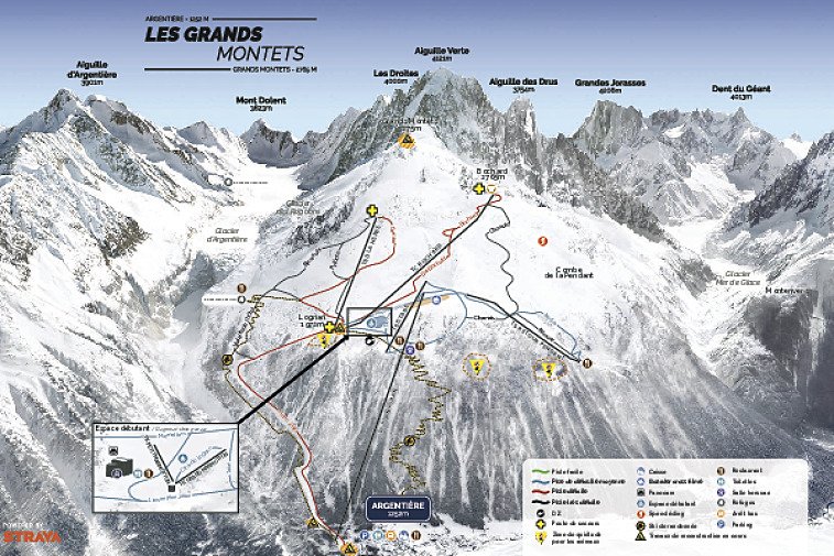
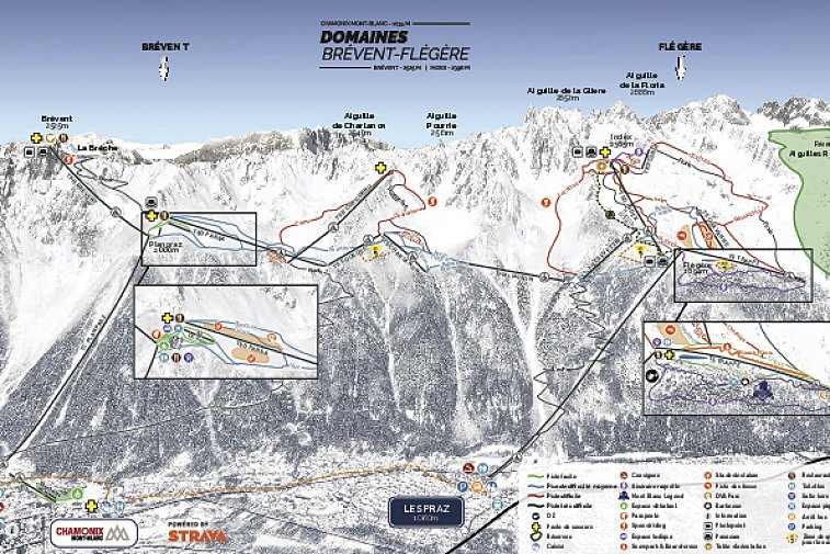
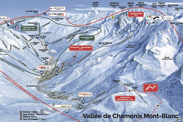
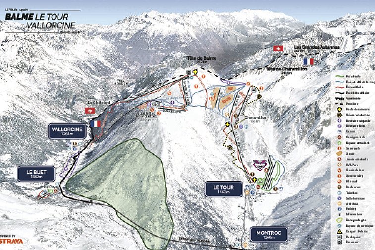
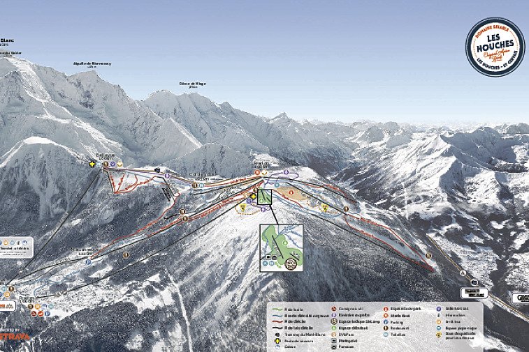
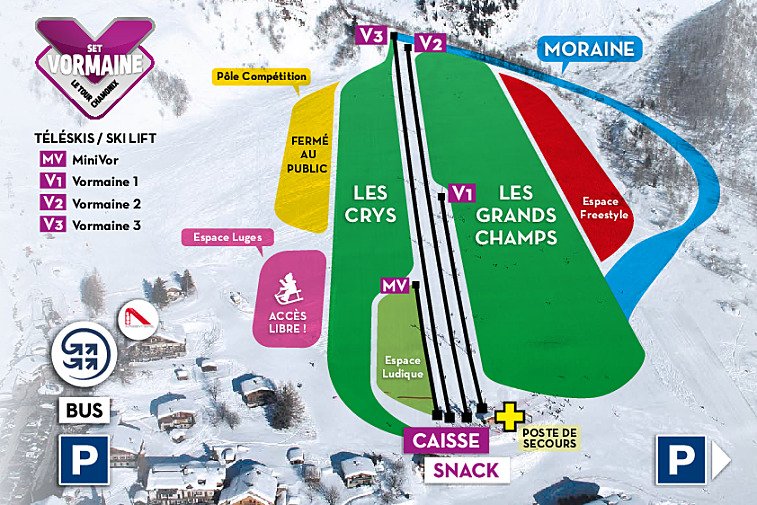
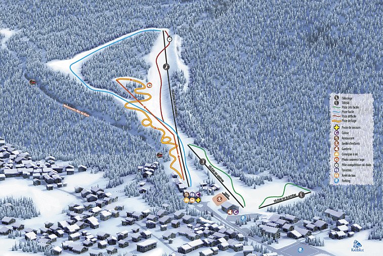
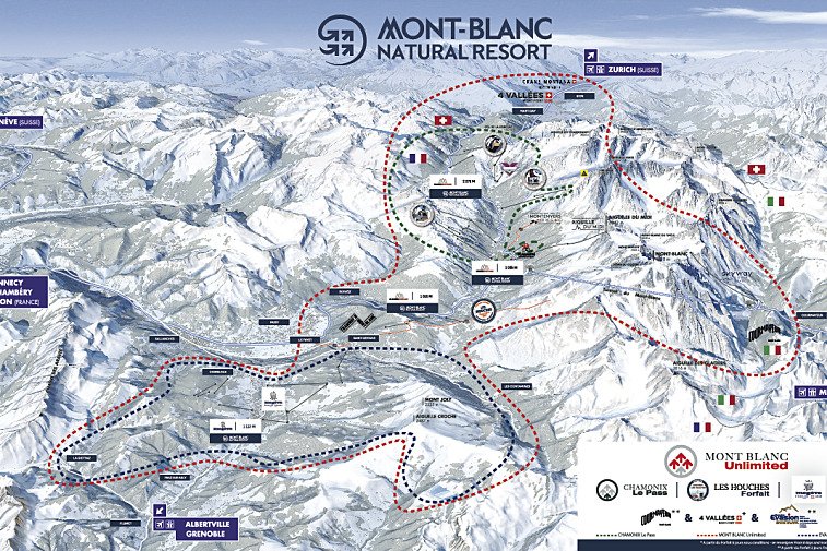
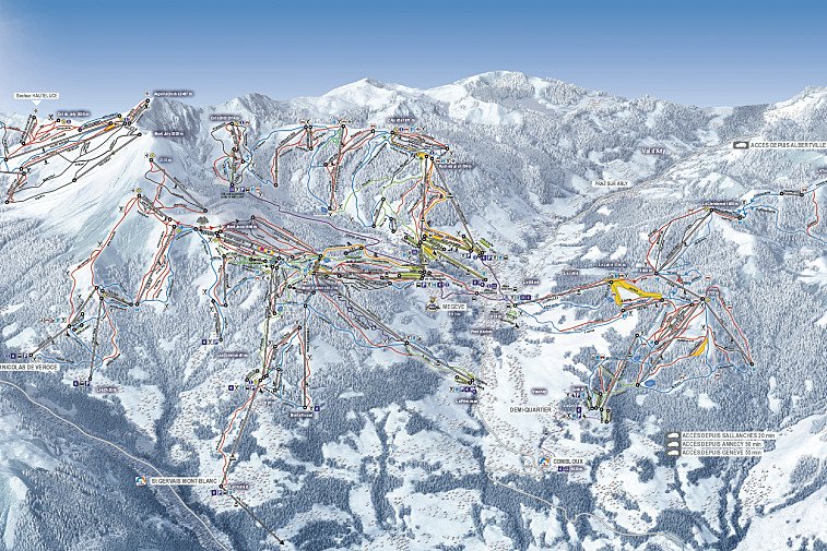
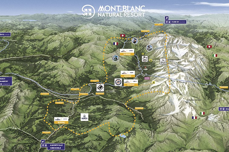
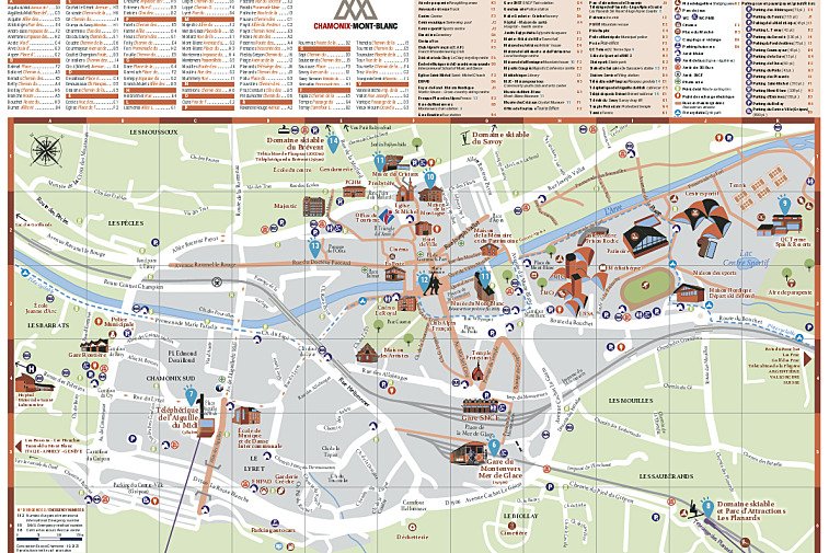
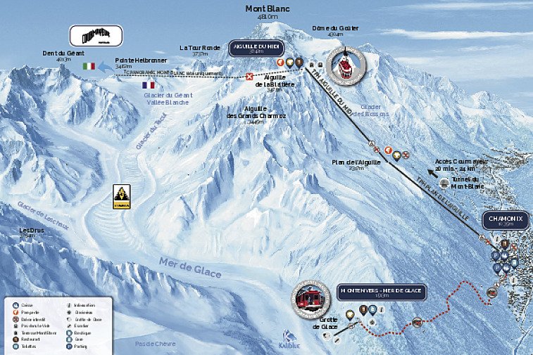
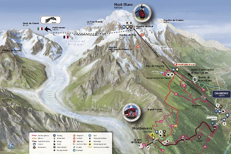
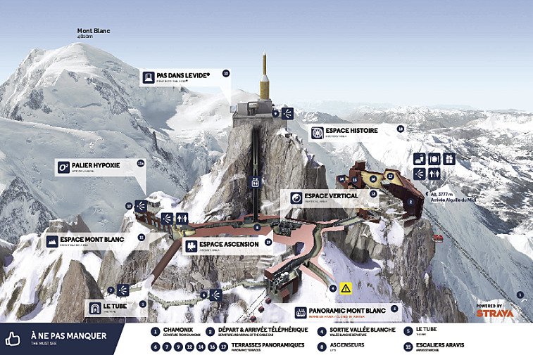
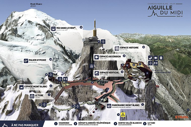
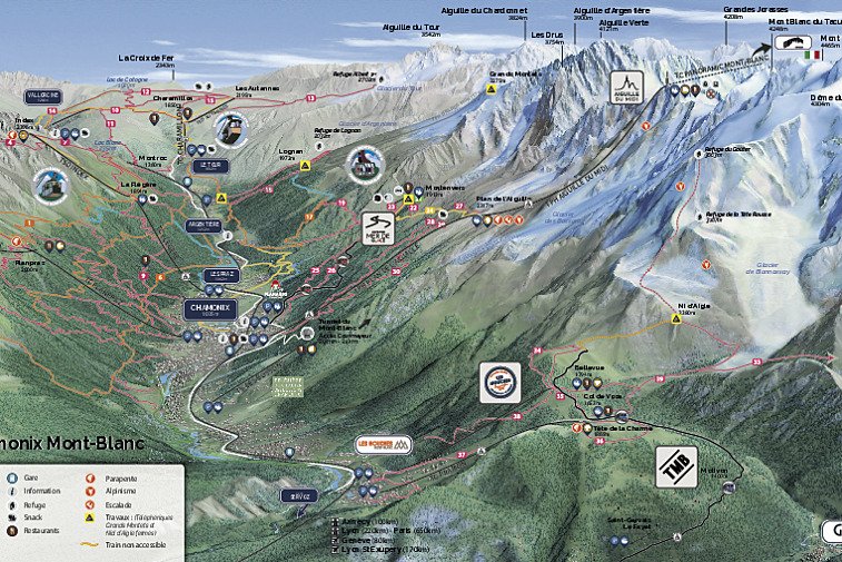
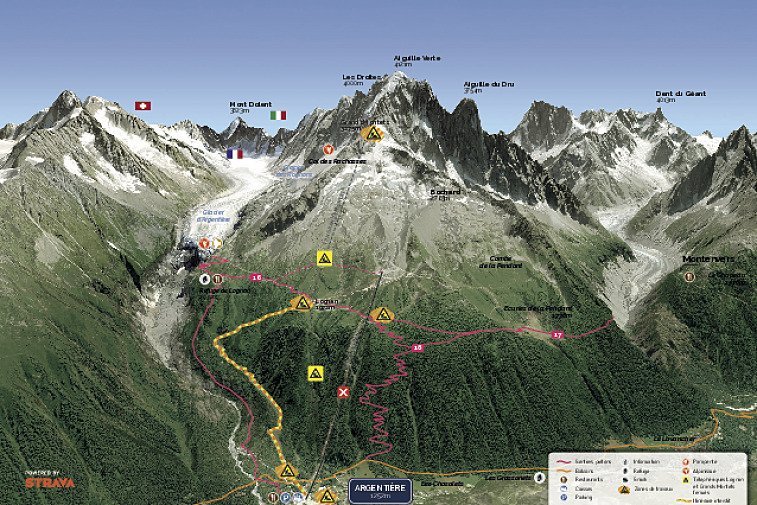
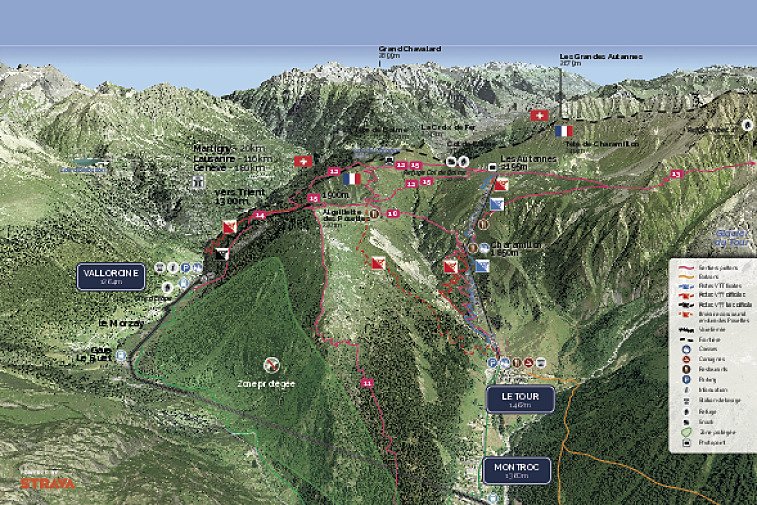
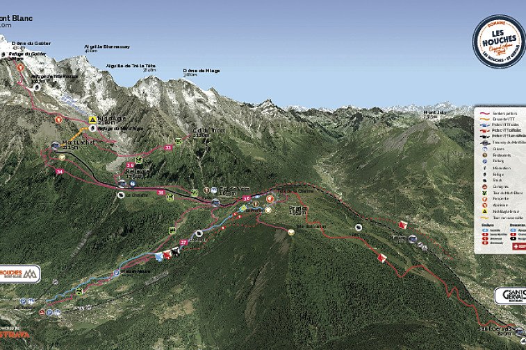
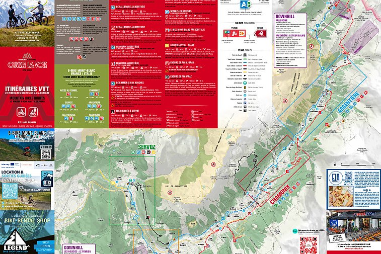
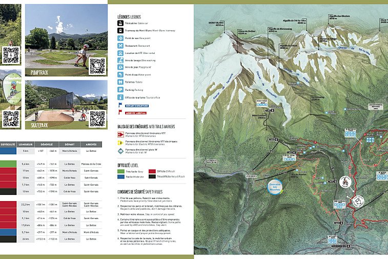
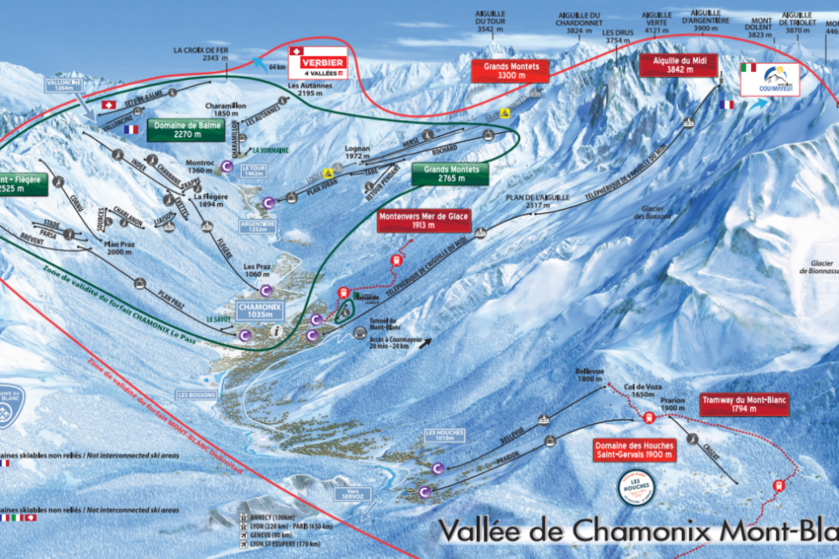
Download PDFs of the latest ski maps, town maps and trail maps in Chamonix.
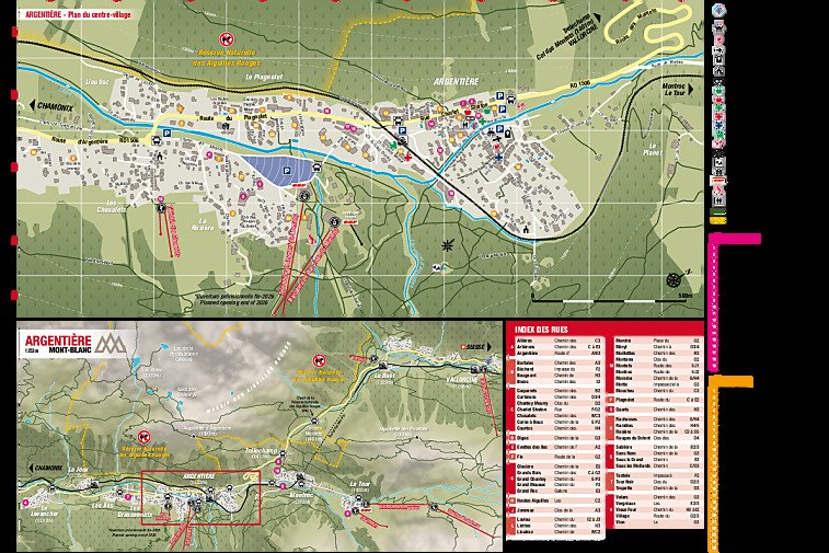
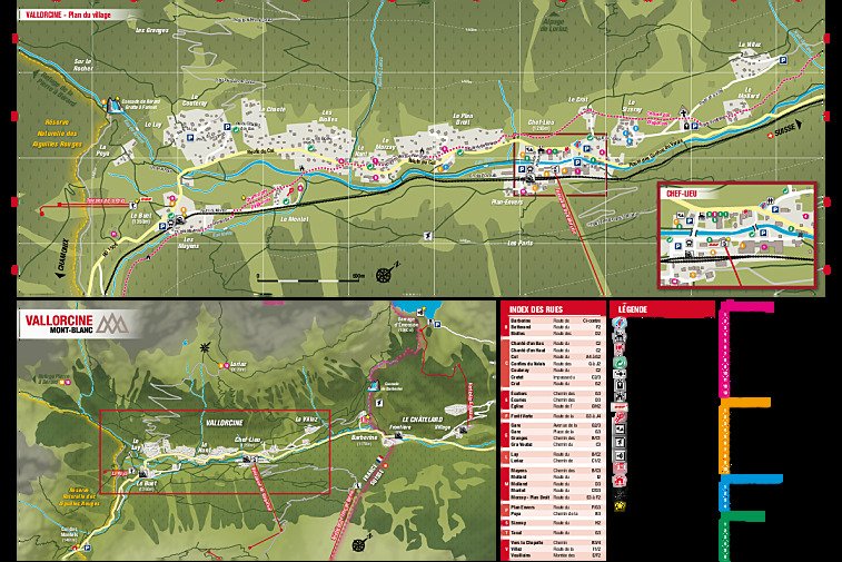
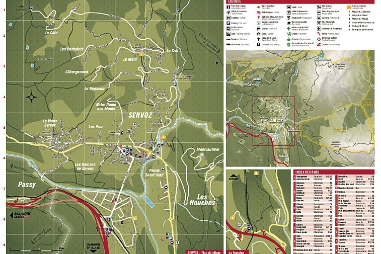
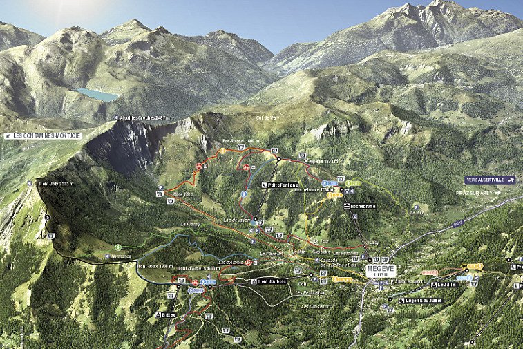
Although commonly referred to simply as Chamonix, the Chamonix valley is actually made up of several towns and villages, each with their own distinct character. These include places like:
This means that within the valley, there are distinct ski areas, mountain bike trails and hiking routes.
Jump to
Piste maps
The ski lifts are marked on the piste maps using straight black lines. There are four types:
- TK - téléski (drag)
- TS - télésiege (chair)
- TC - télécabine (gondola)
- TPH - téléphérique (cable car)
If you see anything marked 'express', that means a fast, six-person chairlift.
Town maps
These are the maps for the main towns and villages in the Chamonix Valley.
Maps for sights and attractions
Winter walking / snowshoeing trail maps
Don't ski or snowboard? No problem. Chamonix has plenty of snowshoeing trails where you can experience the clear air and crunch of fresh snow.
Ski touring and cross-country skiing maps
Summer hiking and walking maps
Chamonix is a hiking mecca and trails here are very well marked. Even so, it's always a good idea to know where you're heading in the mountains. These are the main Chamonix hiking trail maps.
Mountain bike trail maps
The main downhill mountain bike trails in Chamonix are in Le Tour and Les Houches. Read our guide on mountain bike trails in Chamonix for our top tips and epic spots to ride in the valley.
Paragliding maps
For the best take-off and landing spots in Chamonix, see our guide on paragliding in Chamonix.


